Day: November 24, 2017
Join/Renew Millstreet Community Text Alert
Millstreet Community Text Alert is now accepting applications from those who wish to renew or join the Text Alert System for 2018. Application forms can be collected & returned to Wordsworth Bookshop, Millstreet & Guerin’s Shop Ballydaly. Closing date for receipt of applications is Saturday December 16th 2017.
Historical Maps of Millstreet
In this article we try to bring together all the old maps which made reference to Millstreet or some notable place nearby. The first detailed inland maps come from the early 17th Century, until proper ordinance survey maps in the first half of the 19th century. All the maps below give something different on how our area was mapped / perceived. Some of the maps are are not from field studies, but adapted and combined from other peoples work to produce the map.
You can click on all the maps and see a much larger version, and there are links to the sources of all maps, most of which are much larger maps of Cork, Munster or Ireland.
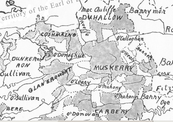
16th Century – McCarthy Sects in the Kingdom of Desmond.
[from Wikipedia – see the Map of Munster] [more on the McCarthys of Desmond]

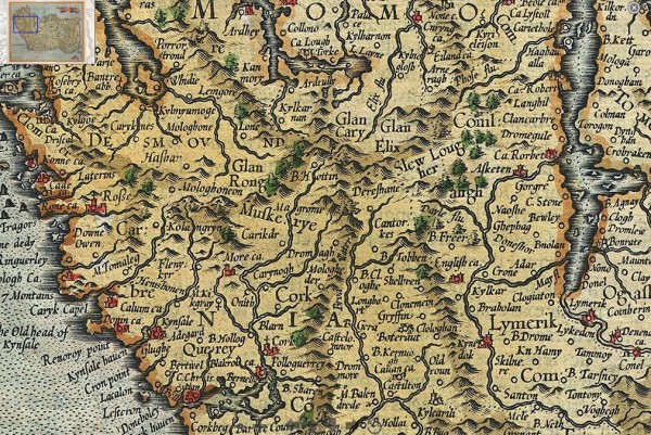
1595/1606 Mercator and Hondius Map of Ireland.
Cork is left to middle at the bottom. It shows Dereshane (Drishane), Dromagh (which appears closer to Cork than Macroom!), Magrome(Macroom), Cantorkes (Kanturk), and Glen Elix (The Glen of Ellis, referring to the Ellis family who lived in the area at the time [ref]. The maps of the time were more interested in the costal waterways than what was inland, thus the waterways were enlarged. There are two versions of the map 1595, and 1606, and they differ only by the colouring of the banner

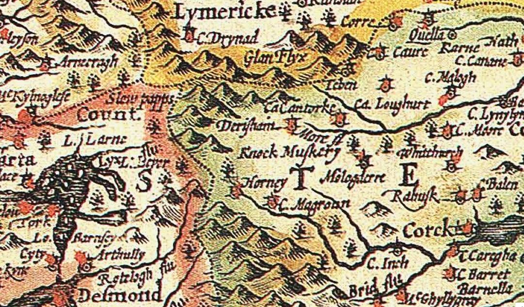
1610 John Speed Map of Ireland: shows Drishane (Derishane), and Mushera (Knock Muskery) [full map] [2.in Black and White] [high quality]

