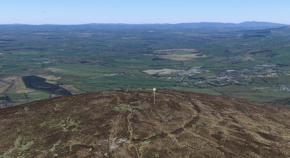
While most of us have been to the top of Clara Mountain, many don’t know that on top, the remains of an ancient hillfort lie under the heather. It can be made out in the photo above which shows Clara with Millstreet in the background. The hillfort is described in a new archaeological site: The Atlas of Hillforts of Britain and Ireland, which maps for the first time all the ancient hillforts across the landscapes of Ireland and the UK:
“Contour fort positioned at the summit of Claragh Mountain, overlooking the town of Millstreet. The circular enclosing element measures 122m in diameter and comprises a single bank of loose stone with no discernible ditch feature. It occupies a total area of 1ha. Possible original entrance at WNW. Up to four breaks in the bank have been created in recent years. Near the center of the interior, a sub-rectangular enclosure, 19m E _ W, 14mN _ S, is defined by a setting of stones. A cairn, 8m in diameter and 0.5m in maximum height is incorporated in to W section of the hillfort bank. Sections of peat at summit suggest an even blanket of peat approximately 0.2m in depth. Some heather growth in interior. There have been no archaeological investigations of this hillfort.
Entrance: Simple break in hillfort bank, 8m wide. West side”
