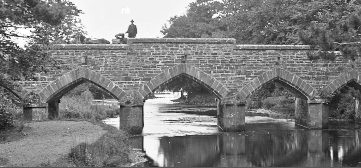
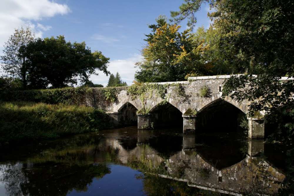
Drishane Bridge is a five-arch road bridge over the Finnow River, built c. 1859, having dressed sandstone walls, and stepped parapets with sandstone copings. Cut sandstone chamfered voussoirs to pointed arches. Ashlar sandstone V-cutwaters to south elevation, with ashlar sandstone imposts. Stile to north wall with roughly dressed sandstone steps leading to river.
Appraisal
It is a well-designed and finely executed structure bridge, clearly constructed by skilled craftsmen. The pointed arches are unusual in form and present an attractive, rhythmical silhouette in the landscape. The dressed sandstone masonry fits tightly together, with a high degree of precision. The stepped parapet walls add interest. The cutwaters, whilst primarily functional, add decorative interest to the south elevation. The bridge retains sandstone steps to the north which lead to the river. The bridge is associated with Drishane Castle demesne. [1]

Location
It is about 90m upriver from the Railway Bridge, 130m upriver from the the meeting of the Blackwater and the Finnow, and also about 200m from Drishane Castle.
Wallis’ Bridge?
There are many references to this bridge as Wallis’ Bridge, especially in the 1890’s OSI Map, but there are also many reference to the Bridge over the Finnow at the Railway Station as Wallis’ Bridge. It’s possible that both were called Wallis’ Bridge at different times, the one beside the Railway station before the 1860s, and this one after!

 A closer view of Drishane Bridge from the Lawrence Collection 1909, that appears in the above postcard. Note the man with the horse and trap on the bridge.
Drishane Bridge (1990) looking downriver. Note the bank of sediment on the left has been removed to allow for better flow of the water., Though the speed of the water through here is quite slow during a flood, because of Blackwater in the background us often higher and stops the water from moving quickly downstream.
The view from Wallis’ Bridge looking upriver (what the man with the pony and trap in the above photo would be seeing)
 This photo is taken from where the Blackwater and the Finnow meet. The steel bridge is the Railway Bridge, while Wallis’ Bridge can be seen in the background. Wallis’ Bridge is seen in the background. Again, it is part of the Lawrence Collection from 1909
 Drishane Bridge pictured through the trees from the entrance drive of Drishane Castle [2017]. Note the four gullets on the right of the photo which were added not long after the bridge was built, in order to ease pressure on the bridge after it was lucky not to be felled in a flood in 1859.
 Drishane Bridge – September 2019
========

When was the bridge built?
The 1840s OSI Map (above) shows no bridge, only stepping stones.
Wallis Bridge is mentioned in the planning for the railway in 1851: “… and terminate by a junction with this company’s line, at a point near Wallis’s bridge, in the townland of Dooneens, in the parish of Drishane”, but this is definitely the bridge at the Railway station (noted form the townlands in the plans).
From the architectural report at the top of this article says that the bridge was build about 1870. (TODO: find source again)
But then there is the extract below about building a new road to the bridge and gulleys, which seems to say that Drishane Bridge was built just before 1859.
“PRESENTATIONS TO THE GRAND JURY: … Denis O’Connor, Nicholas O’Donnell, and Jeremiah Kelleher to build and waterpave 18 two-feet gullets and make 16 perches new road connetion with the new bridge now built over the river Fennow, on the road from Mallow and Kanturk to the Millstreet Railway, on the lands of Drishanemore and Dromin (*Dooneens*), and to cut and slope the new bank at both sides to bring the river fair on the bridge, at £12O.
There was lengthened discussion regarding this presentation- Mr. Jackson, C.E. observed there were peculiar circumstances connected with this presentment, it was always observable that whenever the finnow rose, the Fennow also rose to proportionate height. Upon this occasion however, the Fennnow now rose only about six inches, andl only the bridge was very well built, it would have been swept away.
Mr. French—Where is the bridge ?
Mr Jackson —Between Drishane and the Railway Bridge
Mr. French -I think the matter should stand over until the next assizes…”
[Southern Reporter and Cork Commercial Courier – Friday 11 March 1859]
Note: The gullets are on both sides of the bridge, but it looks like instead of building 18 2-foot-gullets they build 10 3-foot-gullets, which actually has a larger carrying capacity . Four on the east side and six on the west side (todo clarify again that there are four and six).
How to get there
It’s about 4km from Millstreet. Take the road to Mallow until you get out of town, and pass the entrance to Drishane Castle. Take the second left after the entrance to Drishane Castle (700m), and it’s another 700m down that road to get to the bridge.


